Emlid RTK solution for site work and surveying
Fast to learn and ready to scale, Emlid delivers high precision at every stage—supporting construction, utilities, land management, and more, from first layout to final checks.
Stay in control — from the office to the field
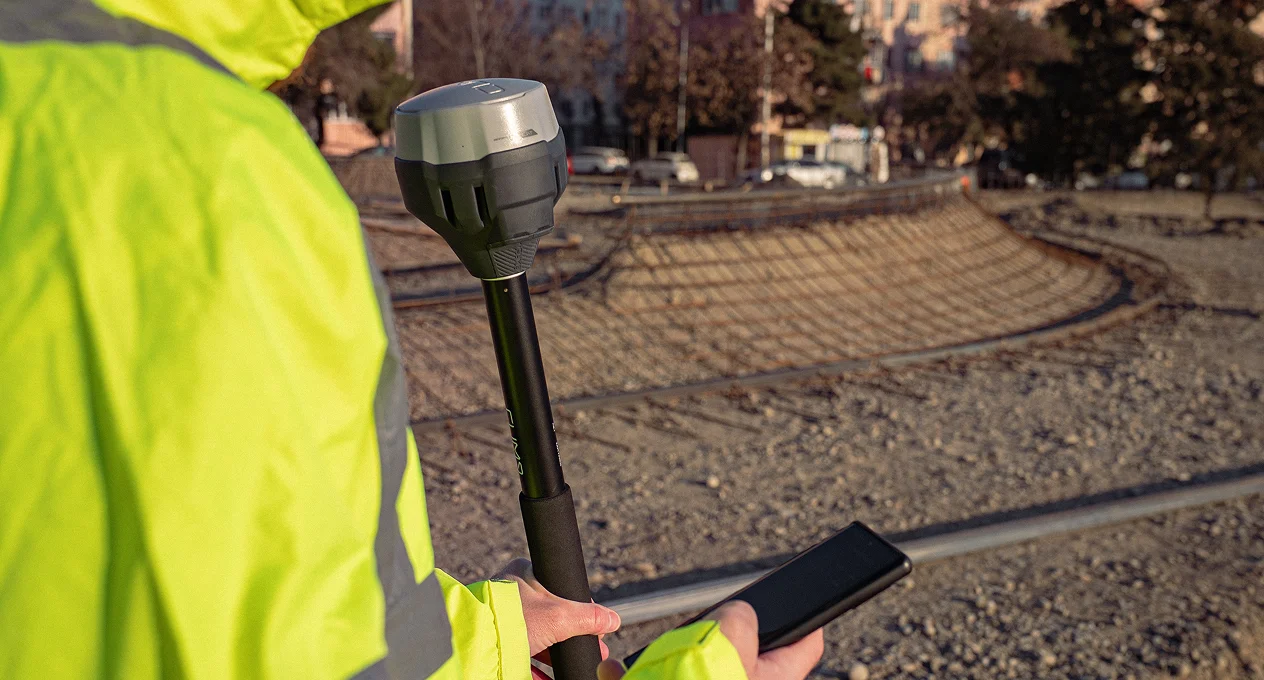
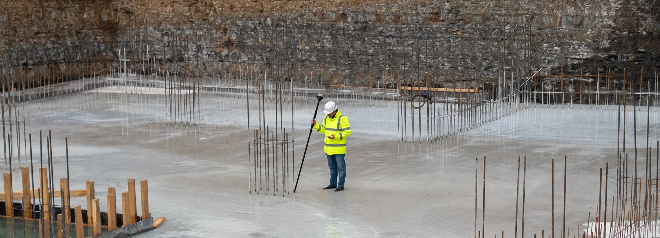
In the field
Work with survey-grade accuracy using Emlid Flow on your phone or tablet and Reach receivers.
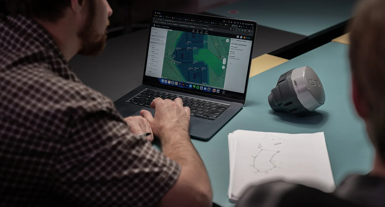
In the office
Sync with Emlid Flow 360 in real-time to manage field data, track progress, and export deliverables.
Customer stories


Topo survey: 500 points in one hour
 Read full story
70-acre construction project
 Read full story
130-hectare residential site survey
Full article
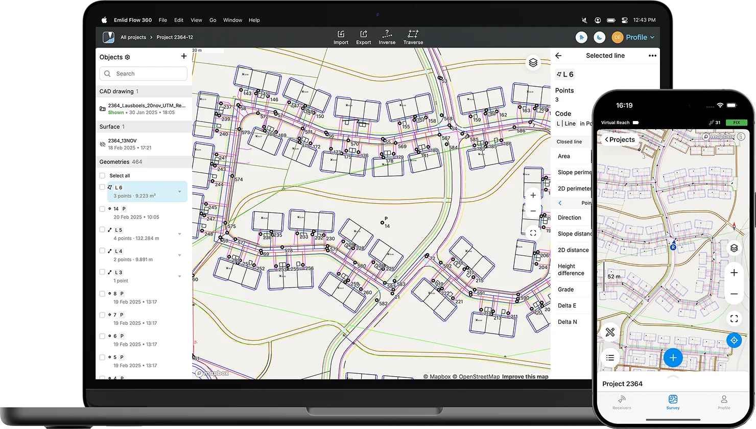
Emlid Flow & Flow 360
Emlid Flow is the mobile app your team uses on site for surveying and layout. Flow 360 connects everything in the cloud, so projects, CAD data, and stakeout reports stay in sync between the field and the office.
 CAD files, DTMs, and geometry calculations
 Real-time stakeout tools and cut & fill display
 Instant cloud sync and team management with Flow 360
 Work from any browser, share data, and export in familiar formats
 Intuitive app for iOS and Android
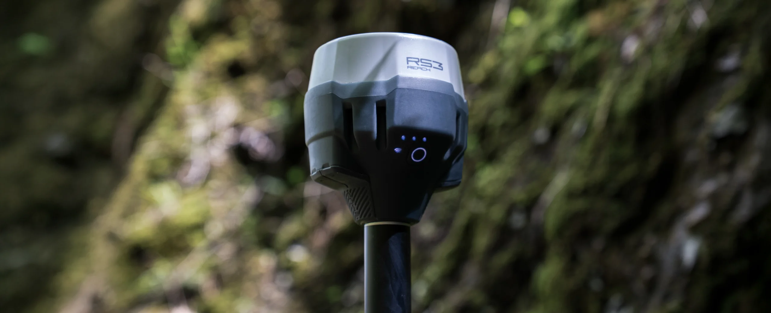
Rugged RTK GNSS receivers
 Powerful built-in battery
Full-day operation on a single charge. Can be charged via a USB-C using a wall adapter or a power bank.
 Centimeter-level accuracy
Multi-band GNSS with support for GPS, GLONASS, Galileo, and BeiDou. Works with CORS or a local base station.
 Works in any weather
Waterproof and dustproof. Can operate in temperatures from –20 to +65 °C.
Choose your Reach
Reach RX2
Ideal for mobile crews and fast setup
Tilt compensation
Compact & Lightweight
RTK rover via NTRIP

$2399
Reach RS4 Pro
Ideal for a full survey kit
Tilt compensation
Dual camera
Base and rover
Dual-band radio
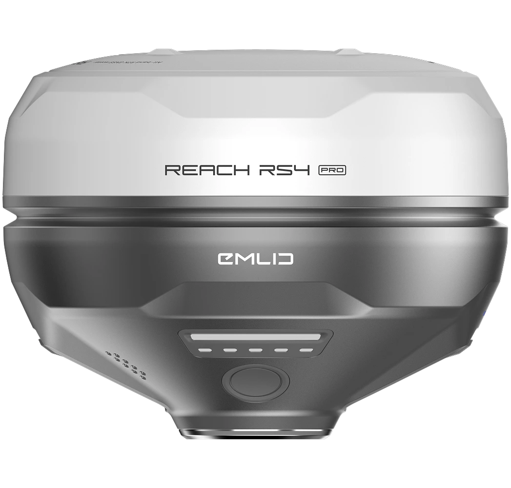
$4599
Have a question?
Ask our team
Fill in the contact form, and we will reply within a working day (9:00-18:00 CET).

Direct Dial: +1 817 865 3334 (ex. 101)
Alternatively, you can text us here:
FAQ
What GPS and GNSS survey equipment and accessories do I need for site work?
For typical site work, you’ll need reliable survey grade receivers to use as a rover and base, and a tablet or mobile phone for companion software. A stable setup is key—so make sure to use a tripod and GPS poles depending on whether you're working with a base or rover. Poles and tripods are used to mount GPS securely during measurements.
Are Reach devices compatible with other survey tools I already use?
Yes. Reach receivers are easy to integrate into existing survey workflows. They support industry-standard formats like NMEA, RTCM3, and RINEX, and can be integrated with different construction survey equipment that support external precise GPS devices. They are also compatible with 3rd-party GPS survey equipment as base or rover. This makes Reach a smart addition when managing varied equipment needs across your projects.
What site work workflows does Emlid Flow support?
Emlid Flow supports a complete range of site work workflows tailored to construction, land development, and land surveying professionals. Whether you’re collecting points for a topo survey, staking out a design layout, or capturing data for as-builts, the app delivers smooth, efficient performance in the field.
With CAD file support, you can import DXF files containing points, lines, and polygons, making it easy to work directly from your engineering or survey drawings. During layout or stakeout, Emlid Flow offers intuitive controls for navigating to features with visual guidance.
The app also includes COGO tools (Coordinate Geometry), such as distance and angle calculations, offset points, and intersections—ideal for solving field geometry problems on the fly during siteworks construction and boundary surveys.
All collected data syncs automatically with the Emlid Flow 360 cloud platform, where you can manage projects, view survey data, and export files to your preferred format. This allows seamless coordination between field and office, making it easier to update design layouts, validate as-builts, and support long-term land management.
What Emlid GNSS tools can be used for topo surveys, as-builts, and design layout in siteworks construction?
Emlid offers a powerful lineup of GNSS receivers—Reach RX2, Reach RS4, and Reach RS4 Pro—perfect for elevation mapping, site grading surveys, and construction verification.
- Reach RX2 is a compact, network rover with tilt compensation designed for quick and reliable data collection using NTRIP corrections. It’s ideal for fast-paced site layout and infrastructure capture where mobility is critical.
- Reach RS4 is a versatile all-band receiver with tilt compensation that can operate as either a rover or a base station. It supports both RTK and PPK workflows, making it well-suited for areas without consistent internet access or correction services.
- Reach RS4 Pro enhances field efficiency with dual cameras, allowing users to survey and stake points with AR guidance and photo-based measurements. This is especially useful on complex construction sites or hazardous areas.
All devices deliver centimeter-level accuracy and rugged durability, even in challenging field environments. When paired with the Emlid Flow app, they offer complete support for elevation mapping, construction validation, and precision layout workflows common in siteworks construction.
How does GNSS compare to total stations and other surveying methods?
GNSS is ideal for fast, open-area land measuring — perfect for site work, layout, and progress tracking. A robotic total station, on the other hand, uses electronic distance measurement (EDM) and measures angles and distances from a fixed point, which makes it better suited for indoor or obstructed areas and not possible for GPS systems. GNSS doesn’t require a line of sight between points, but it does need a clear view of the sky.