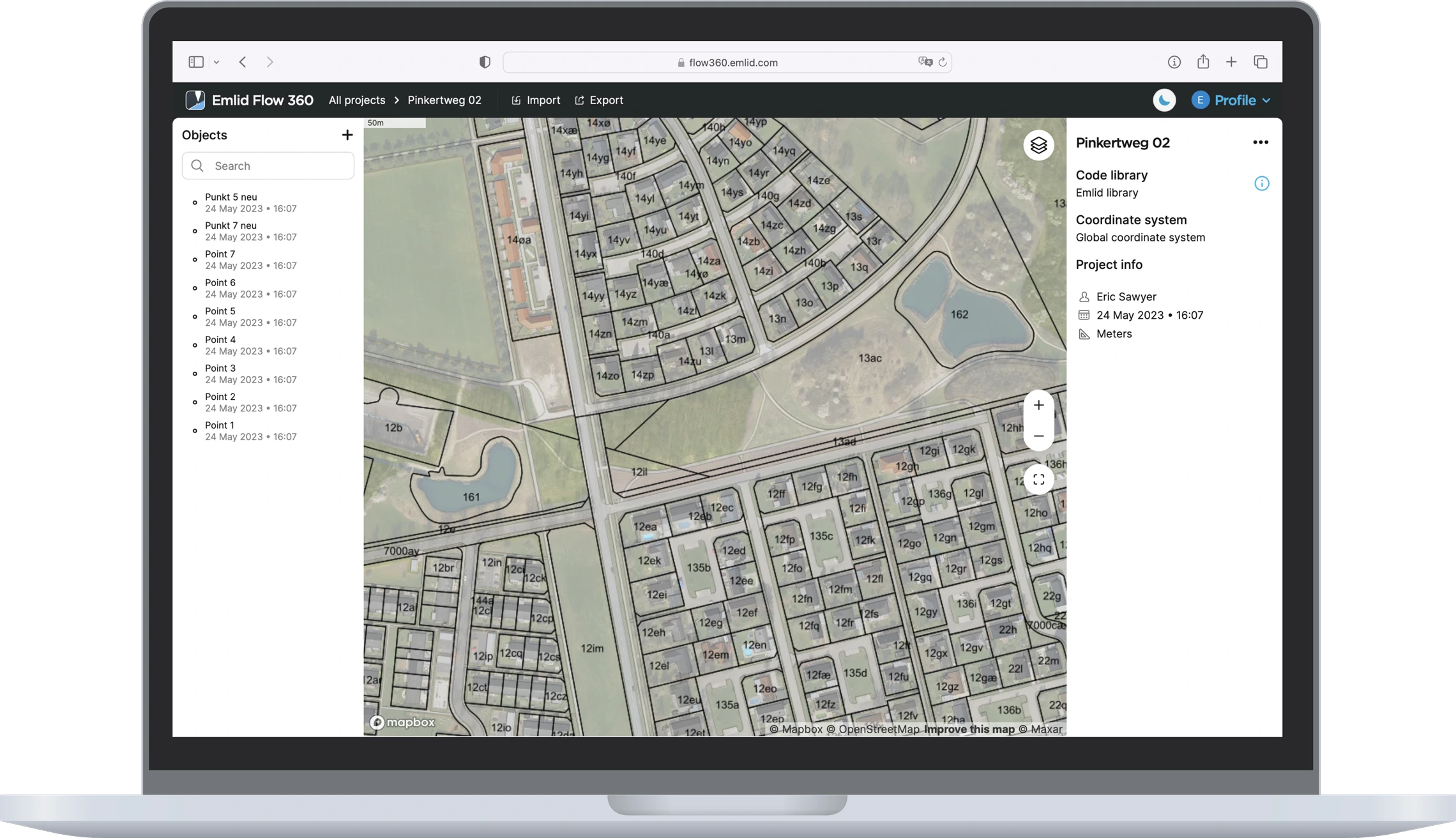
Prepare, export, and manage your survey
data from any web browser.
You no longer need a direct connection to a receiver or to Emlid Flow to export projects. Everything is now synced as soon as your smartphone has internet access. Just log in to Emlid Flow 360 with your Emlid account.
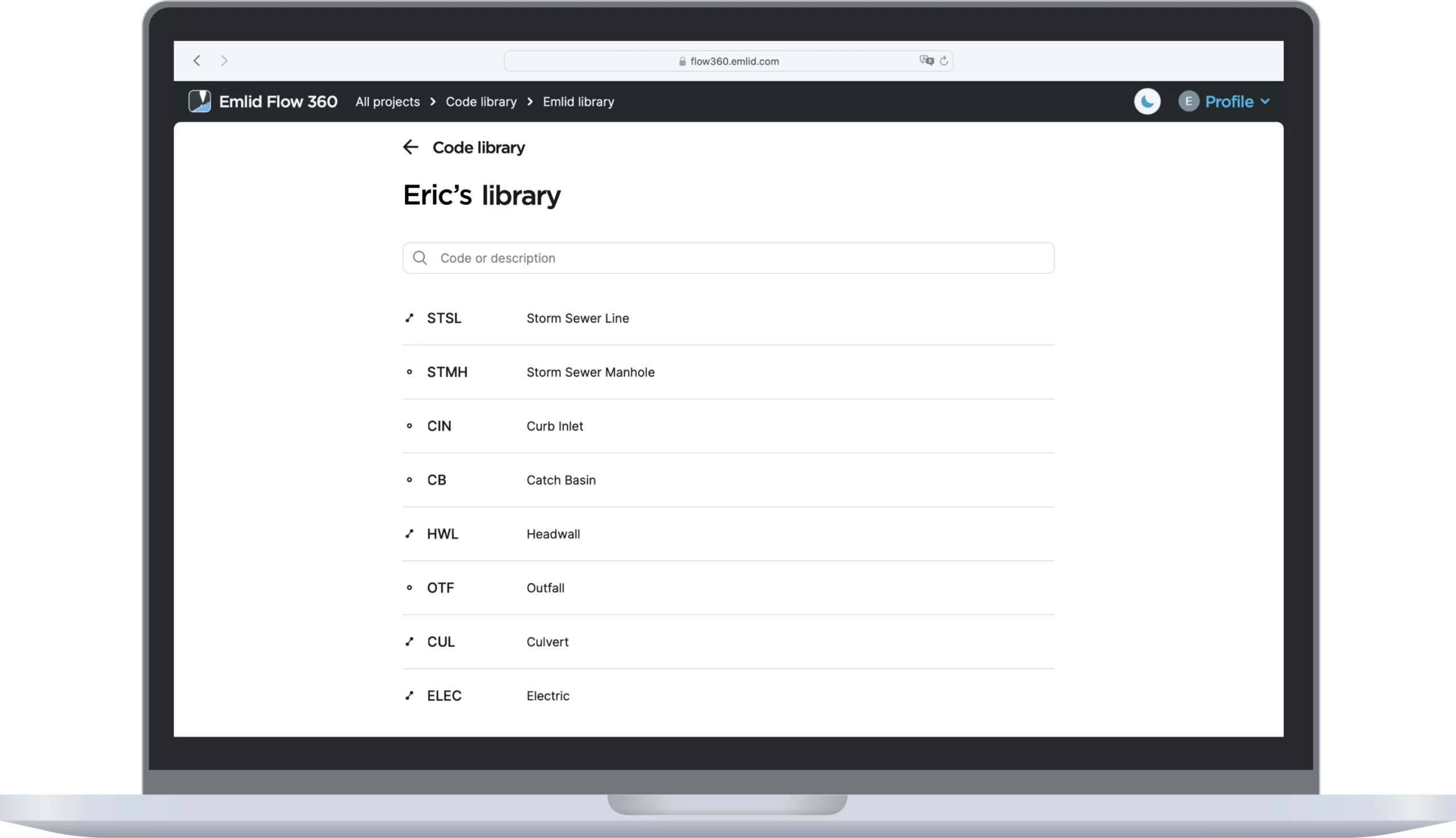
 Create and manage code libraries
Link the codes library to quickly switch between different objects in the field. You can also add new codes to adjust the library for a specific project. And with your Emlid Account, this will be auto synced between all your devices.
 Add WMS/WMTS layers
Elevate your survey workflow with WMS/WMTS layers. Gain access to up-to-date and accurate geospatial data like topographical maps, orthomosaics, composite satellite imagery, and more.
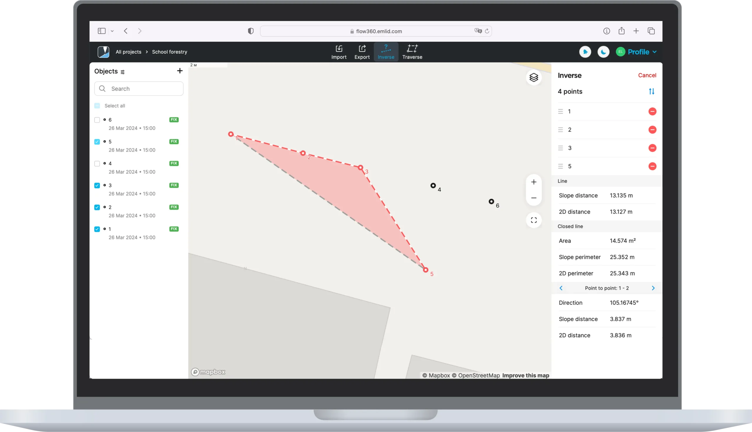 Inverse & Traverse
You no longer need 3rd party software to convert survey plans into real field projects. The Traverse tool allows you to create new geometry directly in Emlid Flow 360 at a given distance and direction from reference points. Inverse tool lets you calculate coordinate geometry attributes such as area, distance, direction, slope, and more.
Some things are just more convenient in the office on a big screen.
Create a project, add a coordinate system, code library, and WMS background layers, upload data and calculate geometry for stakeout, or export ready projects and reports.

A single plan for Emlid Flow and
Emlid Flow 360.
Fill in the contact form, and we will reply within a working day (9:00-18:00 CET).

Direct Dial: +1 817 865 3334 (ex. 101)
Alternatively, you can text us here: